Carroll County, Maryland, United States
time : Apr 23, 2025 12:14 PM
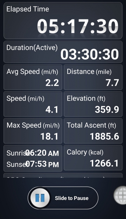
duration : 5h 17m 28s
distance : 7.7 mi
total_ascent : 1886 ft
highest_point : 424 ft
avg_speed : 2.2 mi/h
user_id : eggtrailer
user_firstname : Tom
user_lastname : Martin
Get the ramblr app for FREE! A location-based blog space for nature lovers with GPS or iPhone / Android. Share your hiking, traveling, outdoor fitness stories and GPX on a map.