Ulsan, South Korea
time : Aug 16, 2025 4:47 PM
duration : 0h 7m 32s
distance : 0.4 km
total_ascent : 15 m
highest_point : 44 m
avg_speed : 3.7 km/h
user_id : kys0217
user_firstname : 명환
user_lastname : 김
밀린 산행기가 너무 많아 트랙과 상이함..
[주요 산행경로 요약]
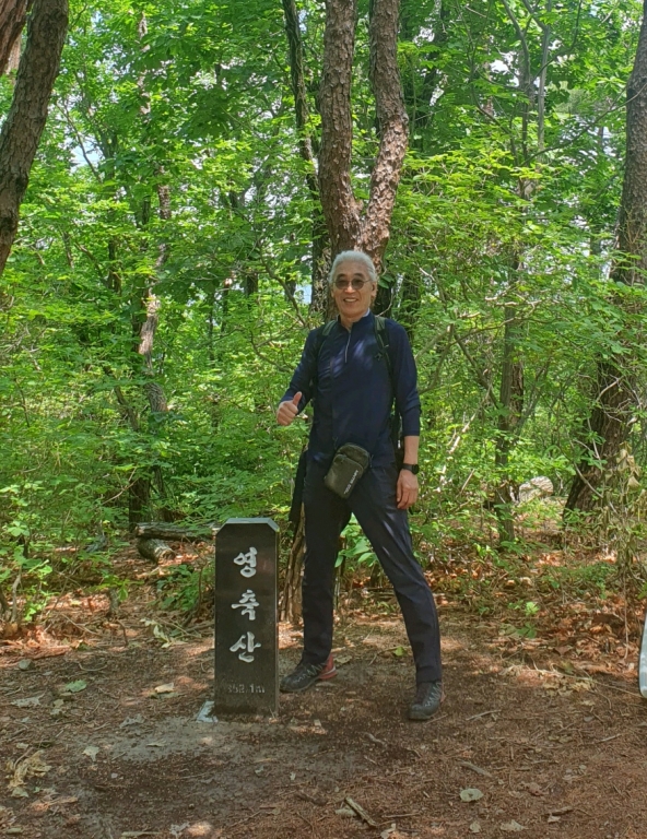
집(05:33) ~ 율리종점(울주군 청량읍 율리 소재) 버스정류장(10:43) ~ 율리영해 제실옆 들머리(10:54) ~ 직_┝_신복초교 분기 쉼터(11:10)_우측 ~ 주등로 접속_좌_T_율리농협 갈림길(11:21)_우측 ~ 좌/직_┾_문수산/신복초교 갈림길 안부 쉼터(11:28)_우측 ~ 영축산(352.1 m) 정상(11:35) ~ 전망쉼터(11:42) ~ 정상주 휴식후 출발(12:17) ~ 산불감시초소(12:24) ~ 사유지표시석 공터(12:45) ~ 신천지교회옆 들머리 진출(12:54) ~ 울과대 버스정류장_산행종료(13:04) ~ 집(15:41)
[산행 소요시간 : 2시간 19분(10:43 ~ 13:04, 풍경감상 및 정상주 휴식시간 40분여 포함)]
[나들이앱 트랙 기준 이동거리 : 5.01 km]
[날씨 : 연이틀 우중충한 날씨가 이어지기에 문수산 정상으로 가다가 순간적으로 방향 틀어 영축산으로.. 우쒸~~ 비는 안 오네...........]
[참석자 : 나홀로 산행(.........)]